Development Resources
The resources on this page help you to learn more about what to expect if you are building or developing on your property. The “Related Links” sidebar provides more information about Vancouver Coastal Health groundwater & sewage, subdividing rural land in B.C., the BC Homeowner Protection Office: Licensing & Consumer Services & the Building Code, manufactured home regulations, land use and regulation in the Agricultural Land Reserve (ALR), and adapting to climate change. The resources including brochures and external websites on this page are provided for your information. If you want more information or site-specific questions, please contact the Planning Department.
Click on the “Planning to Develop Your Property FAQ” below for information on how zoning, property lines, sewar and water servicing, and addressing can affect your property.
Page Navigation
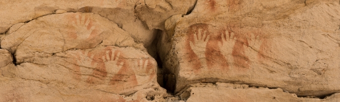
There are over 62,000 known archaeological sites in B.C., 90% of which are of First Nations origin. Archaeological sites are highly valued by First Nations and protected under the BC Heritage Conservation Act (HCA). Altering an archaeological site without a permit is prohibited under the HCA. This applies to sites on public and private land, regardless of whether the site has been recorded or disturbed. To find out if there may be registered archaeological sites on your property, contact the BC Archaeology Branch. If you find bones, shells, artifacts, or other signs of archaeological remains on your property, cease all land-altering activities immediately and contact the BC Archaeology Branch or Tla’amin Nation, contacts in the links below:
BC Archaeology Branch
Phone: 205-953-3334
Online: BC Archaeology Branch Webpage
PDF: Archaeology in BC: A Guide for Property Owners and Developers
Tla’amin Nation
Email: referrals@tn-bc.ca
Online: Tla’amin Nation Website
PDF: Tla’amin Archaeology
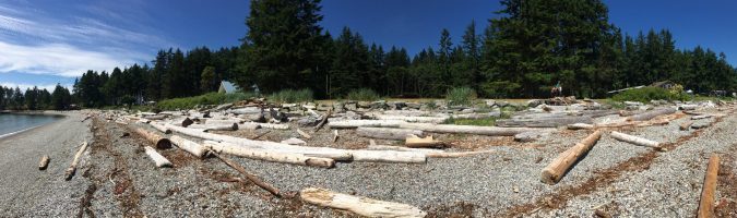
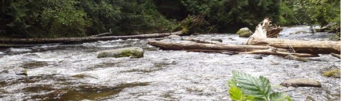
Coastal areas make up most of the land developed in the region. The following information is provided as a resource for questions you might have on living on waterfront property. Click on the following resources to learn more:
Green Shores for Homes, through the Stewardship Centre of BC, is a voluntary, incentive-based program focused on positive steps to help waterfront homeowners restore natural shorelines and enjoy the many recreational, scenic, environmental, and shoreline protection benefits they bring. Click on the links below to learn more:

Riparian areas are lands adjacent to watercourses such as lakes, streams, creeks, and wetlands. These areas are protected under provincial legislation. Despite any exemptions, owners must satisfy themselves that they meet the requirements of the Provincial Riparian Areas Protection Regulations. Click on the following resources to learn more:
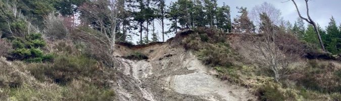
Natural hazard areas are lands that may be environmentally sensitive to development. Hazard lands can include steep-slope areas subject to rock fall or landslide, and low-lying coastal areas and floodplains subject to flooding. Click on the following resources to learn more:
Natural Hazard Area – Technical Reports
Technical reports provide land use planning tools to make informed decisions about your property. These reports and studies are high-level and provided for your information.